InterFlood FAQ
This document answers many of the common questions about out InterFlood flood map service.
Document 5017 | Last updated: 06/11/2020 MJY
What areas of the country does InterFlood cover?
We have 99.96% up-to-date coverage of the entire U.S., its territories and protectorates. Unlike Q3 flood maps, which cover only 1,293 counties, InterFlood flood maps cover each of the 3,141 counties in the U.S. That's over 110,000 flood maps online. If FEMA has a map for your area then we have a map for your area.
Where does InterFlood get its data?
InterFlood's data is gathered from CoreLogic, then overlayed on a digital map from Google. This produces a modern, easy to read flood map that includes street names, major waterways, and more.
How often are the InterFlood flood maps updated?
InterFlood flood maps are updated at a minimum of once each month. For instance, in 2001, FEMA updated nearly 3,300 flood maps, averaging about 275 updates per month.
Why is my property in the wrong place on the Location Map?
Geocoding software can sometimes produce property geocoordinates that are inaccurate to a distance of 500 ft. This inaccuracy is actually very small when you consider the irregularity of property shapes, street placement, block numbering, etc. InterFlood shows you the geocoded property placement on a location map so you can verify that the property was properly geocoded. If your property is in the wrong location, simply click the map to adjust the property placement.
Why does InterFlood's map number differ from FEMA's map number?
In some locations, the map numbers returned by FEMA are based upon a state-wide map numbering convention developed by North Carolina, which is consistent with the State’s Land Records Management Program. The map numbers returned by InterFlood use a community based map numbering convention. However, both map numbers are acceptable for purposes of the National Flood Insurance Program. Click here to verify a North Carolina map number.
What is an "Exact Match" or "Zip Code Fallback" geocode result?
An "Exact Match" means that InterFlood found exact geocoordinates (latitude and longitude) for the property address you entered. A "Zip Code Fallback" means that InterFlood was unable to find the geocoordinates for the property address you entered but did find geocoordinates for the property zip code. When this happens, InterFlood marks the center of the zip code area on the location map. You can then simply click the correct location on the map to place your property exactly.
Why doesn't InterFlood find a Flood Map for my property?
Some communities do not participate in the FEMA flood mapping program. InterFlood automatically logs any property locations for which no flood maps were found. These logs are then sent to our data provider, CoreLogic, for resolution of any problems which may have prevented InterFlood from providing a flood map.
How do I use InterFlood flood maps with my appraisal software?
If you're using TOTAL, you can use TOTAL's built in integration features to pull maps from InterFlood. Instructions can be found in document 5012. For other appraisal softwares, specific instructions on the process may vary, but typically the basic process works like this:
- Log into InterFlood and look up the appropriate flood map for your property.
- Right-click the flood map and choose Copy from the menu that appears.
- In your appraisal software, paste the image into a map or flood map form. (In some softwares, there is an "Insert from Clipboard" feature you can use instead of simply using the Windows Copy feature.)
Why does InterFlood keep prompting me to log in?
InterFlood uses several security features of your Internet browser to prevent unscrupulous users from generating flood maps without a valid contract. Two of these features are referrer strings, and cookies. Some firewalls block referrer strings and cookies. To use InterFlood you will need to configure your firewall to allow referrer strings and cookies for InterFlood.com and alamode.com. Be sure to make these configuration settings for the domain part of the Internet address only (i.e. use InterFlood.com instead of www.interflood.com)
Doesn't my Support Membership with a la mode entitle me to flood maps?
No. TOTAL includes IDC data, which is flood and census data, but not actual flood maps. With TOTAL and a Support Membership, you do receive Census Tract, FEMA Zone, Map Date, FEMA Map Number, FEMA Special Flood Hazard Area and USPS standardized address in one mouse click, but flood maps are an optional service that may be purchased from the TOTAL Store.
Can I save or print a flood map?
Yes. To save a flood map, simply right-click the map, select Save Picture As… and type in the file name that you wish to save the map as. To print a flood map, simply right-click the map and select Print Picture…. Then click the Print button in the Print window.
Other than actual flood maps, what information does InterFlood provide?
With any InterFlood purchase, you will receive the Census Tract, Map Number, Map Panel Number, Map Effective Date, Flood Zone, Standardized USPS address, county name and community number for the properties for which you would like to retrieve a flood map.
How can I purchase InterFlood?
You may purchase flood maps and access them immediately by pointing your browser to https://TOTALStore.alamode.com/product/InterFlood or call us at 1‑800‑252‑6633.
How much does InterFlood cost?
Visit the TOTAL Store for the latest pricing information on InterFlood or call us at 1‑800‑252‑6633 to speak with a representative.
What type of computer or software is required to run InterFlood?
You can get InterFlood flood maps from any computer. All you need is an Internet connection and a modern web browser.
If you're concerned that your web browser isn't modern enough to access InterFlood.com, visit updatemybrowser.org to see if there's an update available for your browser.
Where does InterFlood get the "Property" or "Prepared for" information?
The Prepared For information is pulled in from the company name listed on your InterFlood account. The Property information is the property's address which was entered.
Can you explain flood zone definitions?
When inspecting the flood map panels, a basic understanding of flood zone definitions is helpful. For example, Special Flood Hazard Areas (SFHAs) have a 1% or greater chance of being flooded in any given year. They are shown on the Flood Insurance Rate Maps with flood zone designations that begin with a letter A or V. Under the law, federally regulated lenders must require borrowers with building that are located in these zones to purchase and maintain flood insurance. Flood zone definitions include the following:
- Zone A99 ‑ Area of special flood hazard where enough progress has been made on a protective system, such as dikes, dams and levees, to consider it complete for insurance purposes.
- Zone A ‑ Area of special flood hazard without water surface elevations determined.
- Zone V ‑ Area of special flood hazard without water surface elevations determined, and with velocity, that is inundated by tidal floods (coastal high hazard areas).
- Zones B, C, and X ‑ Area of minimal to moderate flood hazard (where flood insurance is available but not required by federally regulated lenders.
Why is my account debited when accessing maps I've already downloaded?
This problem arises when the user enters the map information just as they would when they purchase a new map. Because they are getting another new map (regardless of the fact that they have already downloaded that map), they will be charged for it. This is not a bug, and InterFlood is working as intended.
To avoid being charged twice for a map you have already purchased, follow the directions below.
- Point your browser to www.interflood.com and log into your account.
- Click My Account. Your account information should display.
- Under the InterFlood Contract History heading, choose the address of the previously accessed map. Your map will display, and you will not be charged for an additional map.
Related Links
DID YOU KNOW?
InterFlood directly integrates with TOTAL, so adding professional, hi‑res maps to your reports has never been easier — just 3 clicks!
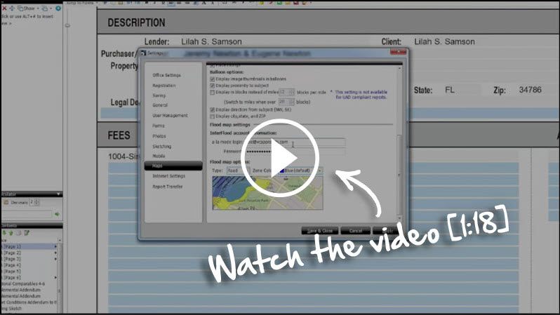
See the step‑by‑step instructions for setting up InterFlood in our video [1:18].