If your map preferences are set
to retrieve flood and census data, TOTAL retrieves the flood and census data for
your subject property along with the USPS data for all report properties in the
third step of the Map
Wizard.
- Review the flood and census data information retrieved by TOTAL. The
confidence levels are displayed using red ( ), yellow ( ), or green ( ) indicators. If you're satisfied
with the data, check the Insert box beside each item to
transfer the data to your report.
- Next, review the USPS information for the properties in your report:
- As with flood and census data, TOTAL displays the confidence levels for
the data using red ( ), yellow ( ), or green ( ) indicators.
- If you're satisfied with the format of the USPS address and zip code,
check the Insert boxes beside each item to transfer them to
your report.
- If you use a non‑standardized address in your report, or a property has
a low confidence indicator and you believe the USPS data displayed isn't
accurate, uncheck the boxes next to the properties, and check the
Assume all addresses are USPS standardized option to bypass
the UAD E&O check.
- Check the Append ZIP+4 box to include the extended
4‑digit code with the ZIP, and provide more specific location information.
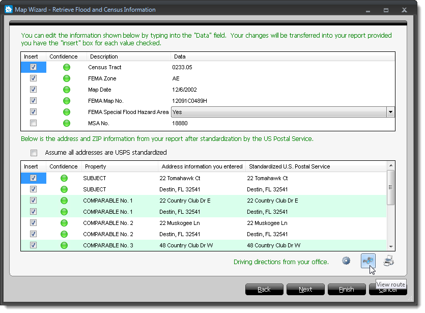
- For your convenience, TOTAL also allows you to retrieve directions from
your office to each property included in your map. Click View
Route to review those directions and click Print
Route if you want to print off a copy. Click here for more information on driving
directions.
- When you're finished, click Next to continue through the
Map Wizard and retrieve a flood map, or click Finish to
transfer your map and data to your report.