To retrieve a location map and place it in your report:
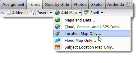
- From the Forms
PowerView, click the Add Map drop‑down arrow,
and select Location Map Only.

- In the window that appears:
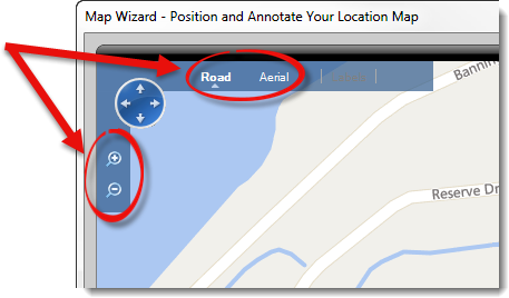
- Toggle the map type between Road or
Aerial based on you or your client's preference.
- Use the magnifying glass icons, or the scroll wheel on your mouse to
adjust the zoom level.

- Click and drag the map panel to adjust its positioning.
- Click and drag the property balloons or the balloon pointers to adjust
their location or position.
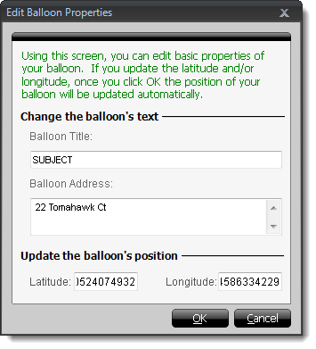
- Double click a property balloon to edit or add information.

- Annotate your map as
necessary using the options at the bottom. Click here for more information on annotating your
map.
- Select a Page Title from the dropdown, or manually
enter a new Page Title on the lower right. The page title
is set to Location Map by default.
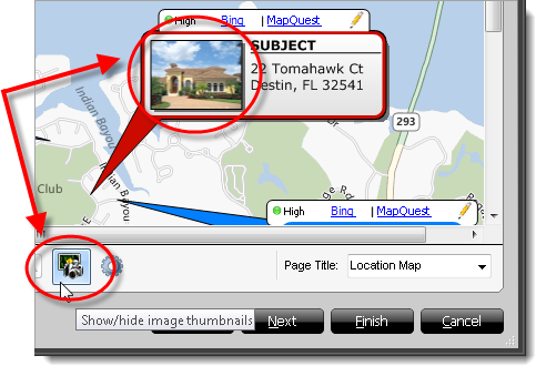
- To display or remove thumbnail images of properties in the property
balloons, click the show/hide image thumbnails icon.

- Click Finish to transfer the Location map back to your
report.


