Flood Zone Designations
This document explains the common flood hazard designations as provided by most major insurance companies.
Document 5023 | Last updated: 01/24/2024 MJY
Understanding the flood zone hazard designations without a suitable reference on hand can be a daunting task. The sheer variety of designations alone can often cause confusion when reviewing flood maps. Below is a comprehensive list of flood zone designations that we have gathered from many major insurance companies.
Use the field below to search for a specific zone, zone name, or terms in the description. The list is filtered and updated automatically as you type.
| Zone | Zone Name | Description |
|---|---|---|
| 100 | Area in SFHA | This is an area inundated by 100‑year flooding for which BFEs or velocity may have been determined. No distinctions are made between the different flood hazard zones that may be included within the SFHA. |
| 100IC | 100‑year Flood Discharge Contained in Channel | An area where the 100‑year flooding is contained within the channel banks and the channel is too narrow to show to scale. An arbitrary channel width of 3 meters is shown. |
| A | Zone A | An area inundated by 100‑year flooding, for which no BFEs have been established. |
| A99 | Zone A99 | An area inundated by 100‑year flooding, for which no BFEs have been determined. This is an area to be protected from the 100‑year flood by a Federal flood protection system under construction. |
| AE | Zone AE | An area inundated by 100‑year flooding, for which BFEs have been determined. |
| AH | Zone AH | An area inundated by 100‑year flooding (usually an area of ponding), for which BFEs have been determined; flood depths range from 1 to 3 feet. |
| ANI | Area Not Included | An area that is located within a community or county that is not mapped on any published FIRM. |
| AO | Zone O | An area inundated by 100‑year flooding (usually sheet flow on sloping terrain), for which average depths have been determined; flood depths range from 1 to 3 feet. |
| AR | Zone AR | An area inundated by flooding, for which BFEs or average depths have been determined. |
| B | Zone B | An area inundated by 500‑year flooding; an area inundated by 100‑year flooding with average depths of less than 1 foot or with drainage areas less than 1 square mile; or an area protected by levees from 100‑year flooding. |
| BE | Zone BE | An area inundated by 500‑year flooding; an area inundated by 100‑year flooding with average depths of less than 1 foot or with drainage areas less than 1 square mile; or an area protected by levees from 100‑year flooding. |
| BX | Zone BX | An area inundated by 500‑year flooding; an area inundated by 100‑year flooding with average depths of less than 1 foot or with drainage areas less than 1 square mile; or an area protected by levees from 100‑year flooding. |
| C | Zone C | An area that is determined to be outside the 100 and 500‑year floodplains. |
| CE | Zone CE | An area that is determined to be outside the 100 and 500‑year floodplains. |
| CX | Zone CX | An area that is determined to be outside the 100 and 500‑year floodplains. |
| D | Zone D | An area of undetermined but possible flood hazards. |
| FW | Floodway | An area that includes the channel of a river or other watercourse (Usually adjacent to Zone AE). |
| FWIC | Floodway Contained in Channel | An area where the floodway is contained within the channel banks and the channel is too narrow to show to scale. An arbitrary channel width of 3 meters is shown. BFEs are not shown in this area, although they may be reflected on the corresponding profile |
| IN | Area In SFHA | This is an area inundated by 100‑year flooding for which BFEs or velocity may have been determined. No distinctions are made between the different flood hazard zones that may be included within the SFHA. |
| NM | Area Not Mapped | An area that is located within a community or county that is not mapped on any published FIRM. |
| OUT | Area Not Mapped | An area designated as outside a "Special Flood Hazard Area" (or SFHA) on a FIRM. This is an area inundated by 500‑year flooding; an area inundated by 100‑year flooding with average depths of less than 1 foot or with drainage areas less than 1 square mile. |
| UNDES | Area of Undesignated Flood Hazard | A body of open water, such as a pond, lake, ocean, etc., within a community's jurisdictional limits, that has no defined flood hazard. |
| V | Zone V | An area inundated by 100‑year flooding with velocity hazard (wave action); no BFEs have been determined. |
| VE | Zone VE | An area inundated by 100‑year flooding with velocity hazard (wave action); BFEs have been determined. |
| X | Zone X | An area that is determined to be outside the 100- and 500‑year floodplains. |
| X5 | Zone X (500‑year) | An area inundated by 500‑year flooding; an area inundated by 100‑year flooding with average depths of less than 1 foot or with drainage areas less than 1 square mile; or an area protected by levees from 100‑year flooding. |
| X500 | Zone X (500‑year) | An area inundated by 500‑year flooding; an area inundated by 100‑year flooding with average depths of less than 1 foot or with drainage areas less than 1 square mile; or an area protected by levees from 100‑year flooding. |
| X500IC | 500‑year Flood Discharge Contained in Channel | An area where the 500‑year flooding is contained within the channel banks and the channel is too narrow to show to scale. An arbitrary channel width of 3 meters is shown. |
| A1 | Zone A1 | An area inundated by 100‑year flooding, for which no BFEs have been established. |
| A2 | Zone A2 | An area inundated by 100‑year flooding, for which no BFEs have been established. |
| A3 | Zone A3 | An area inundated by 100‑year flooding, for which no BFEs have been established. |
| A4 | Zone A4 | An area inundated by 100‑year flooding, for which no BFEs have been established. |
| A5 | Zone A5 | An area inundated by 100‑year flooding, for which no BFEs have been established. |
| A6 | Zone A6 | An area inundated by 100‑year flooding, for which no BFEs have been established. |
| A7 | Zone A7 | An area inundated by 100‑year flooding, for which no BFEs have been established. |
| A8 | Zone A8 | An area inundated by 100‑year flooding, for which no BFEs have been established. |
| A9 | Zone A9 | An area inundated by 100‑year flooding, for which no BFEs have been established. |
| A10 | Zone A10 | An area inundated by 100‑year flooding, for which no BFEs have been established. |
| A11 | Zone A11 | An area inundated by 100‑year flooding, for which no BFEs have been established. |
| A12 | Zone A12 | An area inundated by 100‑year flooding, for which no BFEs have been established. |
| A13 | Zone A13 | An area inundated by 100‑year flooding, for which no BFEs have been established. |
| A14 | Zone A14 | An area inundated by 100‑year flooding, for which no BFEs have been established. |
| A15 | Zone A15 | An area inundated by 100‑year flooding, for which no BFEs have been established. |
| A16 | Zone A16 | An area inundated by 100‑year flooding, for which no BFEs have been established. |
| A17 | Zone A17 | An area inundated by 100‑year flooding, for which no BFEs have been established. |
| A18 | Zone A18 | An area inundated by 100‑year flooding, for which no BFEs have been established. |
| A19 | Zone A19 | An area inundated by 100‑year flooding, for which no BFEs have been established. |
| A20 | Zone A20 | An area inundated by 100‑year flooding, for which no BFEs have been established. |
| A21 | Zone A21 | An area inundated by 100‑year flooding, for which no BFEs have been established. |
| A22 | Zone A22 | An area inundated by 100‑year flooding, for which no BFEs have been established. |
| A23 | Zone A23 | An area inundated by 100‑year flooding, for which no BFEs have been established. |
| A24 | Zone A24 | An area inundated by 100‑year flooding, for which no BFEs have been established. |
| A25 | Zone A25 | An area inundated by 100‑year flooding, for which no BFEs have been established. |
| A26 | Zone A26 | An area inundated by 100‑year flooding, for which no BFEs have been established. |
| A27 | Zone A27 | An area inundated by 100‑year flooding, for which no BFEs have been established. |
| A28 | Zone A28 | An area inundated by 100‑year flooding, for which no BFEs have been established. |
| A29 | Zone A29 | An area inundated by 100‑year flooding, for which no BFEs have been established. |
| A30 | Zone A30 | An area inundated by 100‑year flooding, for which no BFEs have been established. |
| V0 | Zone V0 | An area inundated by 100‑year flooding with velocity hazard (wave action); no BFEs have been determined. |
| V1 | Zone V1 | An area inundated by 100‑year flooding with velocity hazard (wave action); no BFEs have been determined. |
| V2 | Zone V2 | An area inundated by 100‑year flooding with velocity hazard (wave action); no BFEs have been determined. |
| V3 | Zone V3 | An area inundated by 100‑year flooding with velocity hazard (wave action); no BFEs have been determined. |
| V4 | Zone V4 | An area inundated by 100‑year flooding with velocity hazard (wave action); no BFEs have been determined. |
| V5 | Zone V5 | An area inundated by 100‑year flooding with velocity hazard (wave action); no BFEs have been determined. |
| V6 | Zone V6 | An area inundated by 100‑year flooding with velocity hazard (wave action); no BFEs have been determined. |
| V7 | Zone V7 | An area inundated by 100‑year flooding with velocity hazard (wave action); no BFEs have been determined. |
| V8 | Zone V8 | An area inundated by 100‑year flooding with velocity hazard (wave action); no BFEs have been determined. |
| V9 | Zone V9 | An area inundated by 100‑year flooding with velocity hazard (wave action); no BFEs have been determined. |
| V10 | Zone V10 | An area inundated by 100‑year flooding with velocity hazard (wave action); no BFEs have been determined. |
| V11 | Zone V11 | An area inundated by 100‑year flooding with velocity hazard (wave action); no BFEs have been determined. |
| V12 | Zone V12 | An area inundated by 100‑year flooding with velocity hazard (wave action); no BFEs have been determined. |
| V13 | Zone V13 | An area inundated by 100‑year flooding with velocity hazard (wave action); no BFEs have been determined. |
| V14 | Zone V14 | An area inundated by 100‑year flooding with velocity hazard (wave action); no BFEs have been determined. |
| V15 | Zone V15 | An area inundated by 100‑year flooding with velocity hazard (wave action); no BFEs have been determined. |
| V16 | Zone V16 | An area inundated by 100‑year flooding with velocity hazard (wave action); no BFEs have been determined. |
| V17 | Zone V17 | An area inundated by 100‑year flooding with velocity hazard (wave action); no BFEs have been determined. |
| V18 | Zone V18 | An area inundated by 100‑year flooding with velocity hazard (wave action); no BFEs have been determined. |
| V19 | Zone V19 | An area inundated by 100‑year flooding with velocity hazard (wave action); no BFEs have been determined. |
| V20 | Zone V20 | An area inundated by 100‑year flooding with velocity hazard (wave action); no BFEs have been determined. |
| V21 | Zone V21 | An area inundated by 100‑year flooding with velocity hazard (wave action); no BFEs have been determined. |
| V22 | Zone V22 | An area inundated by 100‑year flooding with velocity hazard (wave action); no BFEs have been determined. |
| V23 | Zone V23 | An area inundated by 100‑year flooding with velocity hazard (wave action); no BFEs have been determined. |
| V24 | Zone V24 | An area inundated by 100‑year flooding with velocity hazard (wave action); no BFEs have been determined. |
| V25 | Zone V25 | An area inundated by 100‑year flooding with velocity hazard (wave action); no BFEs have been determined. |
| V26 | Zone V26 | An area inundated by 100‑year flooding with velocity hazard (wave action); no BFEs have been determined. |
| V27 | Zone V27 | An area inundated by 100‑year flooding with velocity hazard (wave action); no BFEs have been determined. |
| V28 | Zone V28 | An area inundated by 100‑year flooding with velocity hazard (wave action); no BFEs have been determined. |
| V29 | Zone V29 | An area inundated by 100‑year flooding with velocity hazard (wave action); no BFEs have been determined. |
| V30 | Zone V30 | An area inundated by 100‑year flooding with velocity hazard (wave action); no BFEs have been determined. |
| Z | Area of Unknown Flood Hazard | An area of Data Discrepancy or an Unclaimed Area. Internal TFHC designation. |
| N | Area Not Mapped | An area that is located within a community or county that is not mapped on any published FIRM (Usually a community not participating in NFIP). Internal TFHC designation. |
| AR/A | Zone AR/A | An area inundated by flooding, for which BFEs or average depths have not been determined. |
| AR/AE | Zone AR/AE | An area inundated by flooding, for which BFEs or average depths have been determined. |
| AR/AH | Zone AR/AH | An area inundated by flooding, for which BFEs or average depths have been determined. |
Related Links
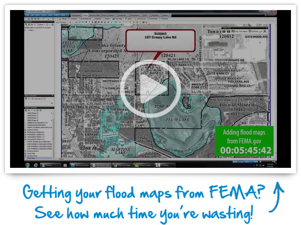
GETTING FLOODMAPS FROM FEMA?
When you're working against a deadline, every minute counts. Seamlessly add our hi‑res, full‑color, automatically sized InterFlood maps straight to your report in only seconds.